€460
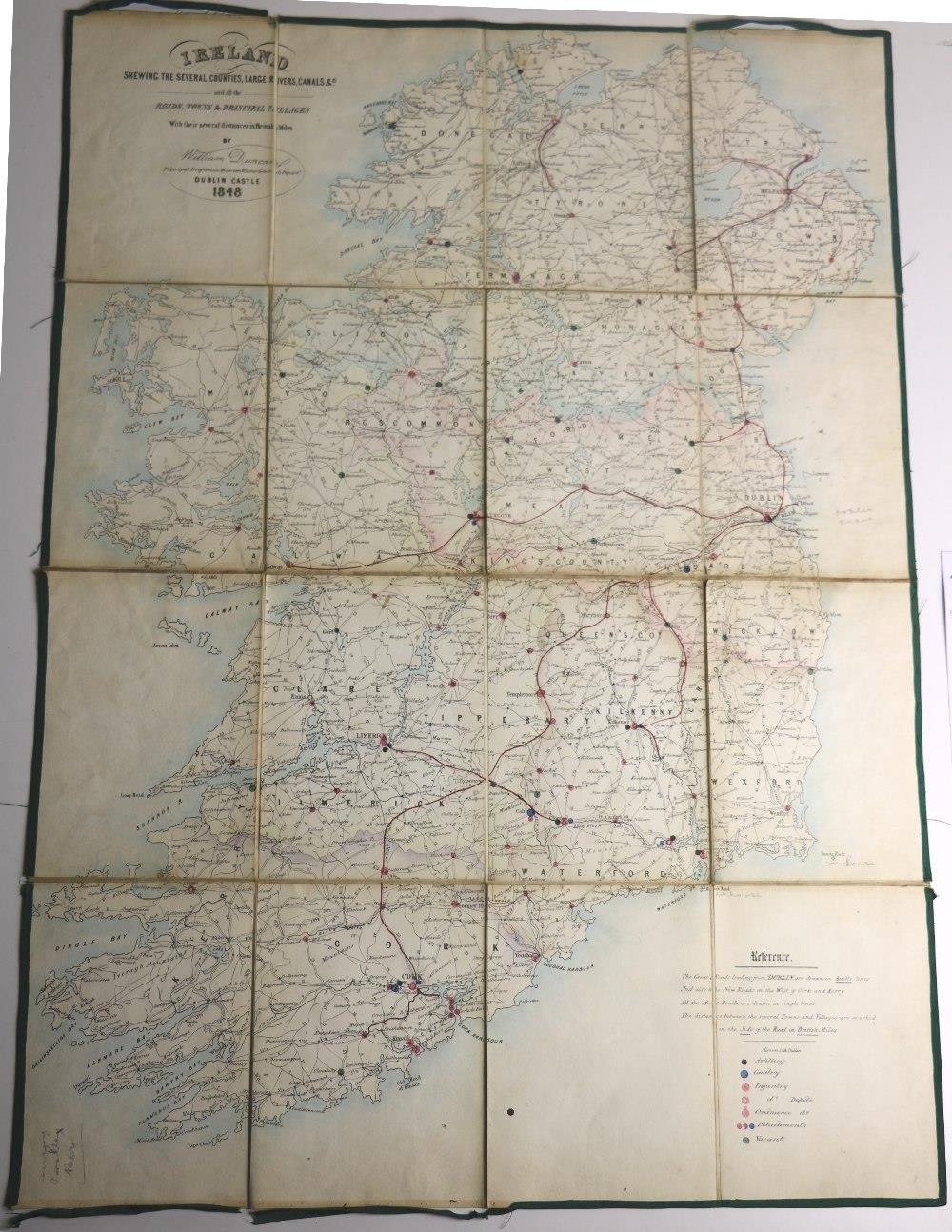
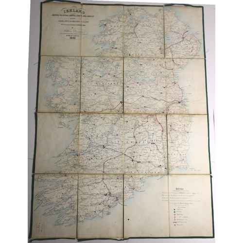
Irish Maps: Duncan (Wm.) Ireland Showing the Several Counties, Large Rivers, Canals etc., engd. hd. cold. map, linen backed Dublin Castle 1848, approx. 28" x 20 1/2" in cloth slipcase; Stanfords New Map of Ireland, in Counties and Baronies, large engd. map, hd. cold. in full & linen backed, approx. 39cms x 31cms, in orig. slip case; Map of the Honorable The Irish Society's Londonderry Estate, lg. linen backed fold. map, hd. cold. in outline, approx. 40" x 38", cloth covers. As maps, w.a.f. Scarce. (3)
Fees apply to the hammer price:
Room and Absentee Bids:
22% inc VAT*
Online and Autobids:
25.69% inc VAT*
+353 (0)56 4441229
[email protected]